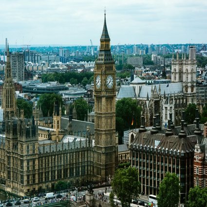
The UK - Building a picture
In this lesson pupils learn where the United Kingdom is located, the constituent countries of the UK, and the difference between the UK and Great Britain
Note: Prior to this lesson, begin a classroom display by creating large outline of the UK to be added to throughout the course of the module.
Key questions
Where is the United Kingdom located in the world / within Europe?
What are the constituent countries of the UK?
What is the difference between the UK, The British Isles and Great Britain?
What does a typical political map of the UK look like?
What seas surround the UK?
What are the names of the capital cities of the countries in the UK?
What are the populations of each of the countries of the UK? How have these changed over time?
What are the flags, other national emblems and languages?
What are the key iconic physical and human features of the UK?
Additional Resources
Printed copies of Happy Families instructions sheet (see downloadable resources) for each table.
Internet access (for UK Trail Activity)
Atlases (for UK Trail Activity)
Web Links
To identify constituent countries of UK, capital cities, seas and islands, mountains and rivers go to Toporopa
Learning Objective
To discover the characteristics of the United Kingdom’s four countries.
Starter
Introduce pupils to blank outline of Giant map of the UK classroom display. Use interactive online resources to identify countries, capital cities, physical, human and cultural characteristics.
Main Activity
The images and information in the Building a Picture PowerPoint presentation (see downloadable resources) introduces pupils to the geography of the UK and its constituent countries, including their political systems, cultures and key human and physical landmarks.
Provide an introduction to the geography of the UK and its location.
The UK is an island nation in Western Europe just off the coast of France. The mainland areas lie between latitudes 49°N and 59°N and longitudes 8°W to 2°E. The UK is bordered by four seas:
-
to the South by the English Channel, which separates it from continental Europe
-
to the East by the North Sea
-
to the West by the Irish Sea and the Atlantic Ocean
Northern Ireland shares a 360 km international land boundary with the Republic of Ireland.
The UK has a total area of nearly 245,000 square kilometres and is composed of: England, Scotland, Wales and Northern Ireland.
Highlight the difference between the UK, Great Britain and the British Isles and explain that these cannot be used interchangeably, as they refer to different country groupings.
-
The United Kingdom: includes England, Scotland, Wales & Northern Ireland
-
Great Britain: includes England, Scotland & Wales
-
British Isles: The UK plus Eire (the Republic of Ireland)
Each of the countries in the UK has a capital city: England (London); Scotland (Edinburgh); Wales (Cardiff) and Northern Ireland (Belfast)
-
Pupils play ‘Happy Families’. Instructions are detailed in the Happy Families Instructions (see downloadable resources). The pack of UK Happy Families cards (see downloadable resources) comprises 9 families (each of 4 cards) showing well known physical and human landmarks from different parts of the UK. The game requires groups of three or more, and the idea of the game is to collect whole families.
-
Pupils complete the UK trail map activity. Instructions are detailed in the UK Trail Map Instructions (see downloadable resources). Using an atlas and internet searches, pupils identify the iconic UK locations/landmarks and place the number of each in the correct place on the UK Trail Map (see downloadable resources). Once pupils have all 26 numbers in place, they join up the numbers with straight lines.
Extension
Using the scale on the UK Trail Map (see downloadable resources), pupils calculate:
-
The distances for each stage of the journey
-
The total distance travelled to visit all 26 landmarks
-
Assuming an average speed of 50 kilometres per hour, what the total travel time for the UK Trail would be.
Pupils (in groups of four) search images using a child-friendly search engine of the 26 iconic UK locations listed and generate a UK Places Mosaic for display adjacent to the UK Class Map.
Plenary
Ask pupils to work together as a whole class to remember as many mountains, rivers, London landmarks, and seaside resorts as they can. Write the places up on the board as you go along.
Pose the following questions to initiate a closing whole class discussion:
Have you visited any of the iconic landmarks of the UK, if so, which?
Which of the iconic landmarks would you most like to visit and why?
File nameFiles
File type
Size
Download
