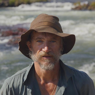
Conservationist, National Geographic Explorer, and TED Senior Fellow Dr Steve Boyes has dedicated his life to preserving Africa’s wilderness areas and the species that depend upon them. A native of South Africa, he founded the Cape Parrot Project in 2010, with support from National Geographic. He is the Founder and Chairman of the Wild Bird Trust.
In 2015, Steve launched what has become the National Geographic Okavango Wilderness Project to support the establishment of community-based systems of protection based on detailed, repeatable ecological surveys and long-term environmental monitoring systems spanning the Okavango Basin in Angola, Namibia and Botswana. Steve and his research team focus on establishing detailed early 21st century hydrological and ecological baselines as part of their mission to help local governments preserve built-in long-term resilience to the impacts of climate change. The focus right now is protecting the “Angolan Water Tower”, which was only recently been described by his team and is the primary water source for the world’s largest transboundary conservation area and two-thirds of Africa’s remaining elephants.
His team, led by Dr Rainer von Brandis, descend into the satellite imagery and remote sensing data by undertaking large-scale ground-truthing surveys and expeditions, discovering new species, taking eDNA samples, deploying permanent hydrological and meteorological monitoring stations, monitoring wildlife populations using camera traps, and mapping all birds, wildlife and human activity noted along their multi-month river transects. They create 360-degree transects on EarthViews, build “story maps” to make scientific discoveries accessible to the public and use ArcGIS Survey123 forms for expert data capture. They measure the heartbeat of these ecosystems on the ground and amplify the value of satellite imagery and remote sensing data.
-
The Okavango Wilderness Project is more than understanding the water and landscape of the Kalahari Desert and the Okavango Delta in Botswana. It is understanding the character of the water in the entire system, starting with the water tower in the Angolan Highlands, to understand the interconnectedness of the entire region.
-
By integrating sensors, data collection and mapping, the team is using GIS to visualize wildlife migration and find patterns to help everyone understand how everything is connected.
-
Throughout their research, the Okavango Wilderness Project team has identified more than 143 new species to science such as fish, bats, mice, lizards, snakes, mushrooms, dragonflies and more.
-
Having a better understanding of the physical geography begins with understanding human geography of the area.
-
Looking to solutions is about working with the people and understanding their unique culture and a key to creating a sustainable future for the region is to work with local organizations to develop community-driven programs.
-
Together, Dr Boyes and his team are working with the communities to rebuild a sense of pride and ownership in the landscape, protecting a place that has been dangerous to explore due to conflict and land mines planted during the war.

